The Most Dangerous Hikes In All Of Arizona, According To Research
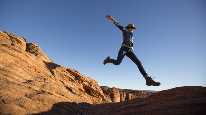
A Southwestern state with some glorious outdoors, Arizona will be all too familiar to adventurers. It is, after all, where to find the Grand Canyon, an iconic slice of nature, but also the national park with the highest number of deaths in America. Even though large parts of the state are covered in deserts, travelers will also come across secret swimming holes where they can cool off. There are places in Arizona to skydive, ski, paraglide, go rafting, and hop on a hot air balloon. The state is equally a great destination for hiking, with trails all over its lands, from its vast tracts of ponderosa pine forest to its spare, serene desert spaces.
Some trails are easy jaunts, simple enough to do in a pair of old sneakers, while others are extremely dangerous and require some advanced hiking nous. The more complex ones might feature technical requirements needed to complete them, or suffer from a lack of shade, which can be dangerous given the state's notoriously blistering summers. Working through official data from sources like the National Park Service and traveler accounts, we've put together a rundown of the most dangerous ones out there.
Bright Angel Trail
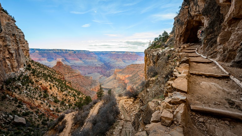
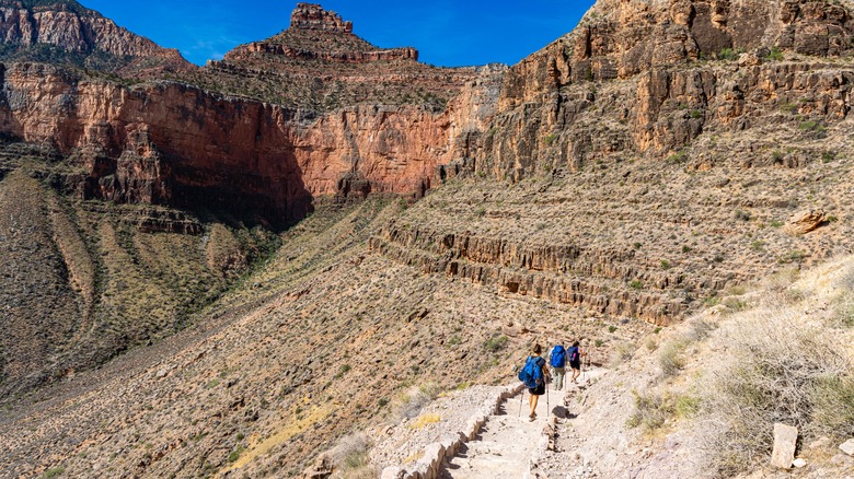
This isn't just a treacherous hike when compared to others within Arizona. It is also one of the most dangerous hikes in America. Located in the Grand Canyon, it might be billed as the most popular trek within the park according to the National Park Service (NPS) — which almost suggests that it's a walk in the park — but that shouldn't overshadow the very real dangers of the Bright Angel Trail. Sure, travelers can enjoy some truly breathtaking views of the interior contours of the winding canyon and a sense of natural grandeur from within the formation itself. But these visual delights also act as a kind of trick, a sensory diversion from the reality of the hike itself, which runs from the rim to the bottom of the canyon.
There are tons of switchbacks there that can hobble the knees on the descent, and that will feel like purgatory on the way back up. The NPS, in fact, calculates that the walk up takes twice as long as the walk down, which many hikers fail to take into consideration. While the trail itself ripples along the side of a canyon, affording it some shade during certain parts of the day, it still places hikers in an area of suffocating heat, and even out of direct sunlight, the mercury can push past 120 degrees Fahrenheit. This is a trail where the NPS has reported fatalities consistently over the past few years, including a 50-year-old Texan male in 2024, a 36-year-old woman from Indiana in 2023, and a man in his 40s from Louisiana in 2021.
Cathedral Rock Trail
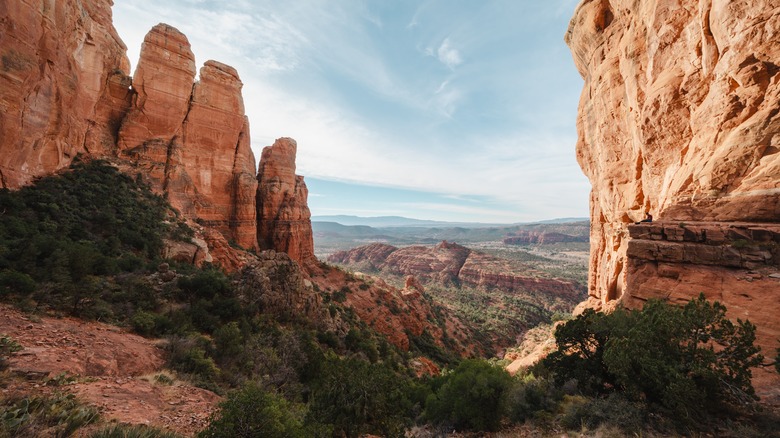
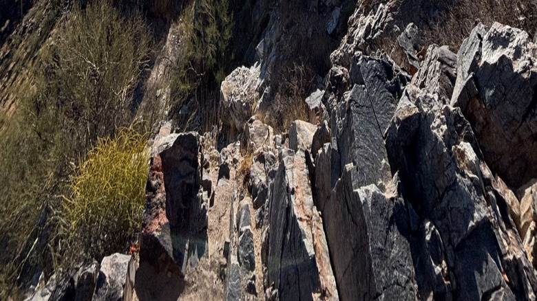
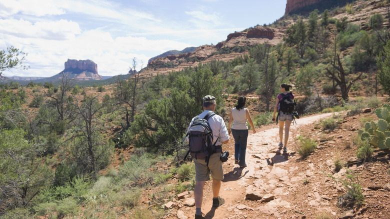
In the heart of Red Rock country, and close to Sedona, the world's "most mindful" escape, this hike is a great option for any traveler looking to experience the rich, sensuous hues of the local landscape. Cathedral Rock takes its name from the towering buttes that stand atop a mound of rock, with a scattering of shrubs and trees offering a variety of colors from the bands of red rock. The hike isn't long, less than two miles up and down, but what it lacks in distance, it makes up for in hazards. The Forest Service notes that the hike, which is in the Coconino National Forest, might make visitors feel like they are climbing a rock face rather than undertaking a traditional hike.
There is no shade, in the same way that rock climbers are often fully exposed to the elements on a wall, so expect searing heat in the summer. The blog Gather + Go Travel notes this point. "During late spring and summer, I recommend hiking only in the cooler early morning or late evening hours, especially as this trail is unshaded." Some sections are extremely steep, with loose rocks that necessitate hikers doing a bit of scrambling. In certain areas, the trail is little more than small grooves in the rock for walkers to push their feet into. In 2024, as reported by Channel 12 News, a hiker fell while on this hike, slipping about 15 feet and incurring some grave injuries. While it was unclear what exactly happened, recent rain in the area had made the rocks slippery, a hazard that is easy to overlook.
Cholla Trail
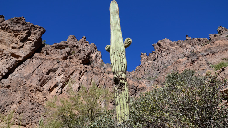
As with many trails within the state, the height of summer is a smart time to avoid the Cholla Trail. One of two trails that gradually winds its way up Camelback Mountain, this hike is easily accessed from Paradise Valley and Scottsdale. The cooler months are definitely the best option for hikers, with October to May identified as the time when the hike is at its most pleasant. The trail is three miles to its summit and back, but that only tells part of the story, and the number belies some of the inherent dangers during the trek. It's a hard slog, and there are loose rocks along the route. Hikers will also find themselves using their hands as they clamber over boulders and scramble across rock faces.
And the incline can be steep in parts, as the blog Climb Camelback notes. "If you're looking for a great workout with beautiful views, the Cholla Trail is for you. Cholla gains about 1,350 feet over 1.47 miles and may not be for you if you're afraid of heights and look out for the loose gravel." The unsteady nature of the rocks there is, perhaps, one of the most devastating dangers. In 2020, Channel 12 News reported how a man who was hiking the Cholla Trail one morning was on a boulder when it rolled and landed on him. The giant rock, weighing 300 pounds, was too large for the traveler to move on his own, and he was only freed after a helicopter rescue, and special equipment was able to extract him. He was taken to the hospital because his legs had been crushed.
Echo Canyon Trail
This is the other trail that weaves its way up Camelback Mountain, and is actually shorter than the Cholla Trail. Measuring 2.6 miles to its terminus and back, the Echo Canyon Trail is a tough excursion, with debilitating heat being one of the main concerns for hikers. Fall, winter, and spring are the best seasons for travelers on this trail. In the summer, when temperatures on the mountain regularly top 100 degrees Fahrenheit, attempting this hike may lead to disaster.
In July 2024, three hikers were out on the trail early in the morning, well before the day had hit its peak temperature, and had to be rescued due to overheating. They set off before 6 a.m., but ran into issues on the return, in the late morning, having run out of water. One of them even had to be transported to safety by helicopter. Beyond the heat, the hike also requires that walkers undertake a certain amount of scrambling on some parts of it, especially the final half-mile, a point noted by this Reddit contributor. "This hike was harder than some of the ones I took in real mountains back in California, very steep, after the first stairs around a quarter mile in, it really ceases to be a hike but more of a rock climbing trip."
Flatiron Hike
The blog WildPaths AZ clearly outlines the pros and cons of the Flatiron Hike. "The views from the tip are incomparable, but they come at a price. You'll face a relentless incline, loose gravel in spots, and obstacles that require use of both your arms and legs as you make your way up the rocky drainage." This route takes in part of the Siphon Draw Trail and Discovery Trail in the Superstition Wilderness Area, and not only presents hikers with striking scenery, but also quad-burning switchbacks. It is six miles in total, and the average completion time of the hike is about four hours for seasoned trekkers. The hike flits between Lost Dutchman State Park and the Superstition Mountains, and begins pleasantly enough. The early stages take place in fields before heading toward a canyon.
Soon, the surface turns to slippery rocks and areas with waterfalls. At some point, hikers will need to scramble up rocks, climb up canyon walls, and the constant changing of scenery can lead walkers to get easily lost and disoriented. The views at the top, a large flat, triangular mountain ledge (hence the name), take in a grand sweep of valley floors and mountain ridges. In the winter after rain, on a clear day with comfortable temperatures, visitors will also be greeted by some pretty flora. In the summer, the conditions aren't so favorable. In August 2019, 44 hikers from Kansas had to be rescued on this hike due to heat stroke, with a couple of them so incapacitated that they needed a helicopter evacuation.
Humphreys Trail
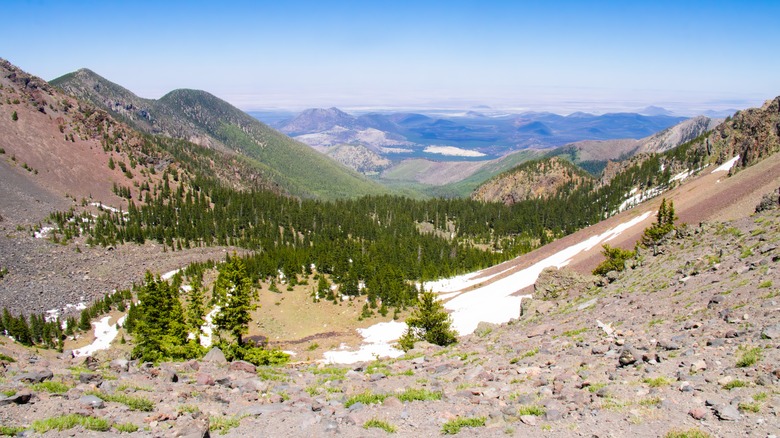
The tallest mountain in the whole of Arizona, Humphreys Peak, sits a short distance north of Flagstaff, a charming destination that gets a lot of snow. The top of this notable geographic landmark resides more than 12,600 feet above sea level, a height at which altitude sickness is a serious concern. Getting to the summit doesn't just require dealing with the lower levels of oxygen available at this elevation, it is also a long way up. The 5-mile trek to the top is very steep in parts, with a gain of more than 3,000 feet in elevation. "The mileage distance doesn't seem obnoxious at first glance, but combining the distance with the elevation, false summits, and numerous switch backs, it can get discouraging on trail," explains the blog The AZ Hikeaholics.
Hikers who do make it to the summit will be rewarded with views of the Grand Canyon and the Painted Desert. While the early stages of the hike might seem almost paradisal, with meadows where flowers bloom painting an image of an idyllic alpine getaway, the walk rapidly transforms into a serious endeavor. There is dense forest along the way, and the slopes of the mountain show evidence of rock slides and clearings created by avalanches. As travelers climb, they will see the vegetation get more sparse, and bent trees testify to the effects of the relentless winds. The higher you get, the rockier the terrain becomes. Snow can fall in any month, while summer is when sudden monsoons can hit. Lightning can accompany the rain, presenting a very real danger to anyone high up and exposed in the open. In 2016, Channel 12 News reported that a 17-year-old was hit by lightning at the top of Humphreys Peak. He died, while his two friends, who were also struck, survived.
Nankoweap Trail
The NPS page for this hike, which is in Grand Canyon National Park, doesn't mince its words. "This trail is classified as MOST difficult of the named trails in Grand Canyon. It has the largest total rim-to-river drop (5640 ft/1735 m) and is one of the longest trails. Hikers must be experienced in canyon route finding; this trail is not recommended for inexperienced or solo hikers." If that weren't enough of a warning, consider the other aspects of this trail. There is little water along the way, and virtually no shade. The trail involves steep descents, the regular crossing of creeks, and climbs through forests.
There are sections where the switchbacks seem to never end, and the path can be uneven, rocky, have loose gravel, and be peppered with spiky brush. Near Marion Point, it is very narrow, less than one foot wide, and there is a 100-foot drop to the side. Hikers attempting this trek will also need to plan meticulously, as this is a multi-day adventure that requires participants to camp overnight. This is definitely a trail only for experienced hikers, located in a park where 16 people died in 2024. Note this passage from Jacob Emerick's Blog. "Nankoweap Trail had absolutely tested my limits and I barely passed. It'll be awhile before I try something like this again, especially with the ridiculous winds that the Canyon often promises."
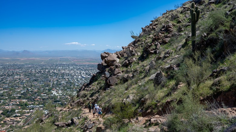
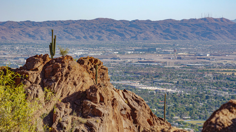
Piestewa Peak Summit Trail
"Almost entirely uphill, this trail weaves through the smaller hills at the base of the mountain before heading straight up," explains the blog Hiking Project. "The terrain is very rocky, with many step-ups well over a foot tall." Piestewa Peak is the second-highest mountain in the Phoenix Mountains Preserve, after Camelback Mountain, and tops out at 2,608 feet. It rises northeast of Phoenix, and east of Glendale, a destination with an upcoming billion-dollar resort. Thanks to its proximity to Arizona's most populous city, this is a well-visited hike, but it is still challenging and fraught with danger. The heat is an obvious threat to consider, with Phoenix recording 113 days in a row in 2024 where the temperature topped 100 degrees Fahrenheit.
The trail starts as a loose concrete path and quickly starts its steep ascent, and steps are carved into the mountain rock to allow hikers to get some footing on the climb. The trail constantly winds around the mountain, and the top isn't in view until near the end, so hikers can never quite tell when the punishment will be over, which can be quite distressing. The final section requires that travelers scramble over some rocks to the top. The distances aren't long, but the trail is merciless, as this Tripadvisor contributor mentions. "Very challenging hike but a great workout. It's only a mile up and a mile down — but very rocky with multiple switchbacks." For some hikers, not knowing what to expect, this can be too much to handle. A case in point was when two hikers were injured and needed to be rescued from the trail in 2022, as reported by The Sacramento Bee.
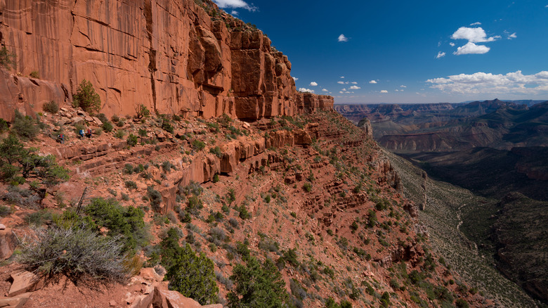
South Kaibab Trail
Consider this when thinking about this trail in Grand Canyon National Park — there is no water along the route. Hikers are advised to carry at least four liters of water when attempting this hike, and they will need it, since the South Kaibab Trail has no shade. This means that the sun will beat down on travelers when it's clear, and storms will lash at them when it rains. Mules also voyage up and down the trail, and there have been instances when hikers were injured by the mules, and vice versa. The trail is clearly defined and judiciously maintained, and for a day hike, Skeleton Point is considered a good destination, a 6-mile hike that comes with a 2,000-foot change in elevation, and can take between 4-6 hours to complete.
Hikers should be prepared to be tested on the early part of the trail, a series of endless switchbacks called "the chimney," which are both steep and narrow. These feel even worse when going back up on the return. While this is seen as the most direct and fastest way to descend to the river at the bottom of the canyon, it's a draining excursion, and in the winter, there can be snow or ice on the trail. "Please be careful — these cliffs are steep," outlines the blog Danielle Outdoors. "It's easy walking down, but very steep going up — don't underestimate it." There have been deaths on this trail, including in 2020 and 2021, as reported by the NPS.
Tom's Thumb Trail

The city of Scottsdale is America's best place to retire in 2025. It is also a good jumping-off point for Tom Thumb's Trail; the hike is also easy to reach from Phoenix, a city with hidden canals. Hikers can expect a route where the ascent is vertiginous enough to be sapping. "There is a significant uphill climb and then it levels off a bit," notes a Tripadvisor commenter. "We went on to the lookout which was nice because most people turn around at the thumb. Much less crowded and a GREAT view." The hike to the end and back is four miles in total, and begins with a stream of switchbacks.
As the trail progresses, the views take in the McDowell Mountains, as well as Scottsdale and the sprawl of Phoenix just beyond. Flora along the way includes wildflowers like California poppies. But such idyllic environs mask the harder truth of this hike, that the heat can be savage, climbing will put your legs to the fire, and there is no water anywhere on the trail. In 2022, as reported by ABC 15, the conditions were too much for a woman and her dogs, who had to be rescued by the Scottsdale Fire Department, with signs of overheating being the culprit.
Methodology
There are hikes all over Arizona, but to find the ones that are the most dangerous, we first looked at sites like The Travel, El Inde, Reddit, and SanTanValley.com to get an idea of which were the hardest. But to winnow down the list to those that really were dangerous, we studied reports by the National Park Service and local news stories that provided evidence of how treacherous these hikes can be. Wherever possible, we also added personal testimony from people who had hiked these trails, so that readers can know what to expect from a firsthand source.