Nevada's Highest Peak Offers A Climb Through Rugged Terrain To Breathtaking Mountain Views
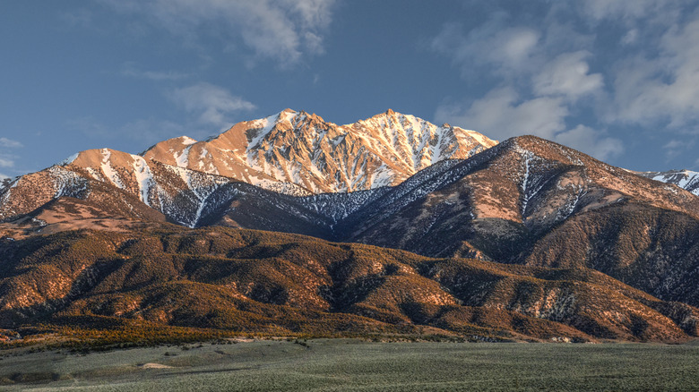
When you think of Nevada travel, you might picture walking the strip at the unhealthy but wildly popular vacation destination of Las Vegas or traversing colorful slot canyons full of ancient art, but it is also known for its mountains. Although Colorado is the most mountainous state in the continental U.S., no one can deny how impressive Nevada's towering peaks are, and its highest mountain top stands above them all. Boundary Peak, so named for its proximity to the Nevada/California border, has an impressive 4,215 feet of elevation gain. Hiking to the top is a seriously difficult route, and it should only be attempted by those with plenty of experience hiking at high altitudes. However, if you're up for the challenge, you'll find breathtaking views waiting for you at the summit.
Located within the incredible Boundary Peak Wilderness (which has 10,000 acres of forest, tundra, and sandy mountain ridges), Boundary Peak is a strenuous day hike over four hours from Las Vegas or almost 50 minutes from the relatively nearby Dyer, Nevada. Once you arrive, you have two options for heading up the mountain: Queen Mine Road or Trail Canyon. The hike via Queen Mine Road is typically considered the better choice, but be warned — it's still pretty difficult. While this route doesn't make the ascent any easier, it might help you avoid altitude sickness. To make sure you're as safe as possible, you should probably not rush up the mountain, no matter which way you come at it. Try to spend some time in the area to let your body adjust before embarking on this feat.
What to expect on the hike to the summit of Boundary Peak
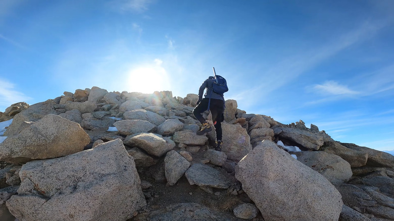
Until you see it, it's hard to imagine just how steep the scramble up Boundary Peak can be. This route should be considered one of those trails that are only for experienced hikers. Portions of this trail are primarily made up of little loose rocks, so it's easy to lose your footing, even with good hiking boots and poles. You should also anticipate great gusts of wind, spontaneous thunderstorms during the day, and frigid temperatures. Along the way, you might see a few other hikers, but most of the time, it will just be you and your hiking buddies alone on the tallest peak in the state. Don't be fooled if it seems like you're reaching the top faster than you expected, as there are a few false summits along the way.
Once you get to the real top, you can look down at the smaller mountains all around you and the impressive, and somewhat taller, Montgomery Peak rising up above you just across the California border. It's a good idea to take a break at the top and catch your breath, because the way down can be treacherous. One hiker on Hike Arizona described making their way down the steep slope with their hiking poles as being akin to skiing. This trek can take over seven hours from start to finish, even for accomplished hikers and climbers, so make sure to leave early.