A Once-Thriving Colorado Mining Boomtown Is An Abandoned Spot With Wildflower Trails Near Aspen
Driving along Interstate 70 through the Rocky Mountains is a bit like journeying into another era. Beyond the mountain scenery, the first thing you'll notice are the countless rusted mining apparatuses and abandoned narrow tracks along the highway. This is because the area was once at the heart of the Pike's Peak Gold Rush (also known as the Colorado Gold Rush), a booming era that brought a wave of economic and industrial growth to the state.
At the forefront of this gold rush was a small town called Independence. A classic example of a boomtown, Independence quickly transformed into a gold mining hub, flourished briefly, and then was abandoned. Today, more than a century after it was deserted, what remains of the town is an archaeological preserve managed by the Aspen Historical Society and the United States Forest Services. Set in an alpine landscape within the White River National Forest, this once-thriving town is surrounded by a network of scenic wildflower trails and hikes, making it an eerily beautiful part of Colorado's gold mining history.
How Independence went from a thriving gold mining town to an abandoned ghost town
Independence, named after the day it was founded, was established shortly after prospectors struck gold in the area in 1879. By 1880, around 300 people had moved to the town. By 1882, Independence's population had increased exponentially to around 1,500 people. Between 1881 and 1882, over $190,000 worth of gold was mined at the site. To put things into perspective, that would be over $6 million today. On top of mining activities, Independence was also a strategic resting stop for stagecoaches crossing over the pass toward Steamboat Springs.
Things shifted very quickly after this initial boom of success. As it turned out, the gold vein was not as deep as expected, and by 1888, fewer than 100 residents remained in the town. Around a decade later, in 1899, the region was hit by the worst winter storm in its history. It was completely cut off from civilization, urging the final settlers to leave their homes for nearby Aspen on skis built from the wooden cabins they once called home. Its final resident left in 1912.
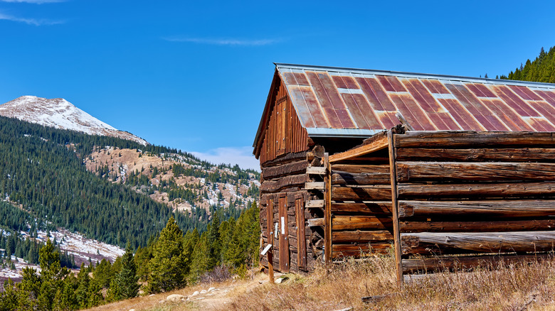
Today, Independence is a ghost of its former self. It's hard to believe that this deserted town, located at an elevation of 10,900 feet and buried under snow for much of the year, once had three post offices, multiple saloons, and several grocery stores.
The best hikes and wildflower trails around Independence
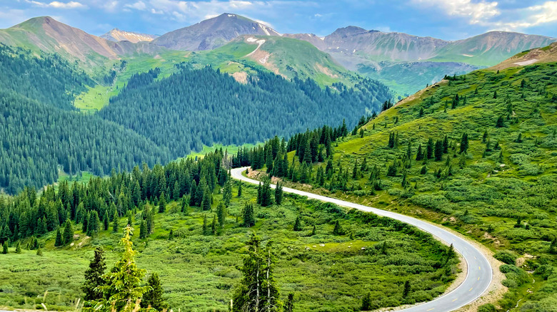
Many of the roads and trails in the area today follow those first laid out by the Ute people, an indigenous group who originally inhabited the land. Independence Pass, once called Hunter's Pass, is one of them. Now a highway with steep drop-offs and 180-degree switchbacks, the pass was built in 1880 to make the town more accessible as a mining hub.
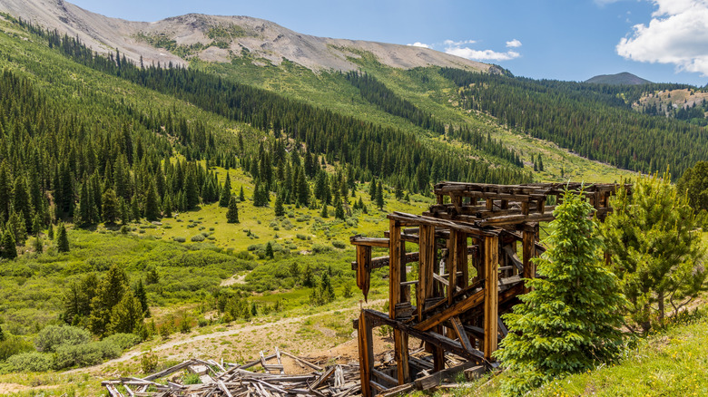
Visitors can retrace the footsteps of the settlers by following a milelong loop through what remains of the town. From the parking area, it's a relatively easy hike to the town along a dirt and gravel trail. From start to finish, the trail takes around 45 minutes, following what was once the town's main street, called Aspen Avenue. The scattered buildings, including the remains of a general store, old stables, and a refurbished log cabin, give visitors a good idea of what life was like during the town's heyday.
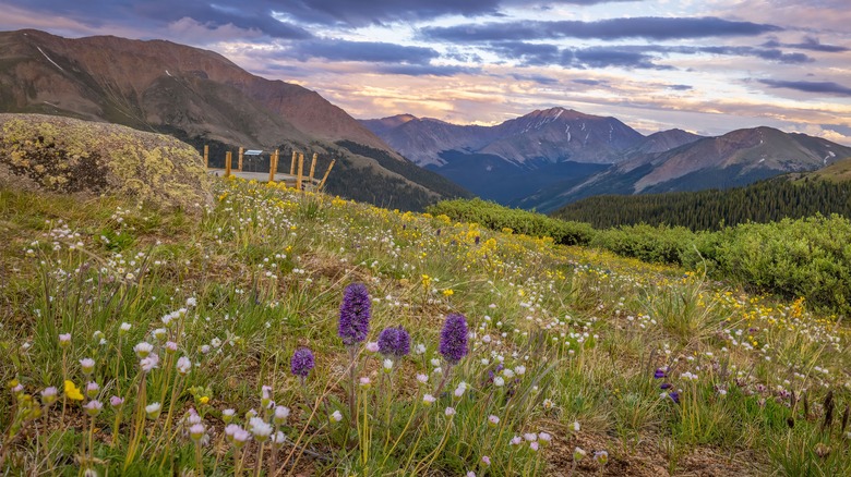
Thanks to abundant snowmelt and high-elevation sunshine, the area bursts into color with wildflowers every spring. Depending on when you visit, the grasslands could be covered with purple fireweeds or blue columbines. The Grottos Trail, located between Aspen and Twin Lakes, is a major highlight for hikers. Beginning on Independence Pass, the trail follows a slot canyon along the Roaring Fork River. While a must-see, this hike is better known for its alpine pools and waterfalls than for its wildflowers. For those visiting during fall, consider hiking the historic 4.7-mile Interlaken Trail farther along Independence Pass. This hike passes yellowing aspen trees and leads to abandoned Colorado attraction.
How to visit Independence Ghost Town
Independence is located around 215 miles from the state capital of Denver, but it's not in the middle of nowhere. The closest town is Aspen, only 16 miles away along Colorado Highway 82 (otherwise known as Independence Pass). There are plenty of high-end hotels and serviced condominium rentals available here. After all, Aspen is one of the prettiest and most expensive ski towns in the country.
While Aspen is home to the Aspen/Pitkin County Airport (ASE), commercial flights at this airport are few and far between, not to mention exorbitantly priced. Civmetrics ranks ASE as one of the 20 most expensive airports to fly into in the country. Instead, most visitors arrive at Denver International Airport (DEN), one of the country's busiest airports, and travel the mountain road in a rented car. Alternatively, shuttle services connect the Denver airport with Aspen.
Admission to Independence Ghost Town is free, but the groups that maintain it recommend a $5 donation per adult on an honor-based system. The donation box can be found by the main entrance. While there are no strict hours of entry, the region is inaccessible during the winter months, when the pass closes due to heavy snowfall. Note that the road along Independence Pass is treacherous in snow, ice, and rain, so be prepared to drive slow if you happen on inclement weather. Make sure to check the Colorado Department of Transport for any road closure updates.