The Pacific Northwest's Long-Distance Trail Through Scenic Landscapes Ends On The Incredible Oregon Coast
We may receive a commission on purchases made from links.
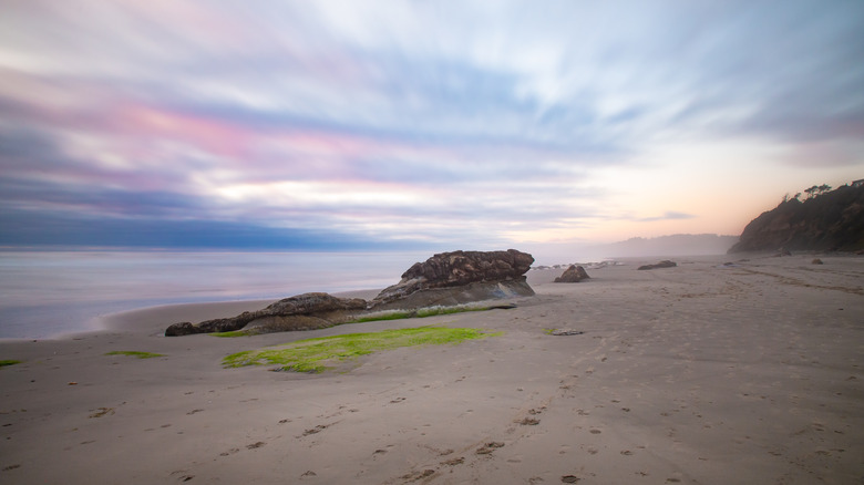
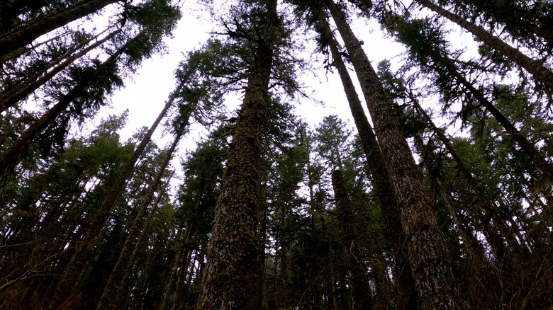
If you're looking for a multi-day backpacking trip with some breathtaking views, incredible wildlife watching, and seclusion from the modern world, you won't want to miss the Corvallis-to-the-Sea Trail. Just like the name says, this route takes hikers on an epic 60-mile journey from the city of Corvallis, Oregon, to the coast. Along the way, hikers will experience the best of the Pacific Northwest, with everything from farmland and wildflower meadows to mountainsides and verdant, misty pine forests. Maybe best of all, the trail ends with the sound of waves crashing onto Ona Beach, where the land meets the Pacific.
While the sights you'll see on the Corvallis-to-the-Sea Trail (affectionately known as the C2C) have obviously been there for a very, very long time, and people have been campaigning to bring this trail to life since the '70s, it was only completed in 2021. Hikers who have explored the trail are reporting that its wilderness portions are incredible, reaching the ocean is enormously rewarding, and the experience of making this trek can be brutal at times. If you're dreaming of one day taking on intensive thru-hikes like The Vermont Long Trail, America's Oldest long-distance hiking route, or the beautiful but deadly Pacific Crest Trail, but aren't quite ready to take the plunge, this three- to six-day trek might be your next adventure.
What is it like to hike the Corvallis-to-the-Sea Trail?
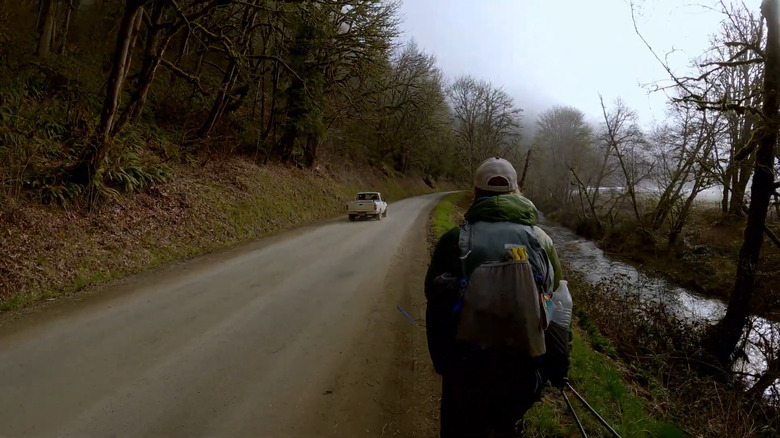
Unfortunately, this trail includes some highway and gravel roads along the way, but if you want to be alone in the wild, don't let that fact put you off. There are still plenty of areas here where your only companions will be trees, babbling brooks, and wild animals — plus, any hikers you meet on the way. This route takes you through the beautiful Big Elk Valley, where you will certainly see people's homes but also soaring red-tailed hawks. You might hear the sound of cars, but you'll also hear the creek rushing and the knocking of woodpeckers hunting for food in the trees.
After hiking up and down the slopes of Palmer Mountain, you will find yourself moving through a forest of towering pines. If you're lucky, you may spot massive elk grazing along the road. From there, the trees give way to farmland and marshy landscapes populated with herons, ducks, and osprey. You're very likely to hear the crashing of waves before you actually see the ocean. Ona Beach State Park, where the trail ends, may not be the largest of the West Coast's beaches, but you still have the opportunity to take in the vastness of the ocean beyond and end your journey by watching the sun sink down into the waves.
Planning the perfect C2C trek
Unless you live nearby, the best way to reach Corvallis (where most begin their hike) is probably to fly into Portland International Airport. From there, all you need to do is rent a car, arrange for a shuttle, or call a rideshare to take you on the 95-mile drive into Corvallis. There are even fewer choices when it comes to where to stay the night.
Because a lot of this route goes through land that is privately owned, camping is only permitted in a few areas managed by the U.S. Forest Service along the way. Fortunately, you'll find signs along the way that indicate whether or not you're allowed to camp, so there shouldn't be too much confusion. Most hikers plan to camp on the marked 0.5 miles of land after the 19-mile marker and the Big Elk Campground found just before mile 33. Make sure to get a permit from Starker Forests by calling 541-929-2477 within a year of when you intend to hike C2C, as there are a few areas where hiking is illegal without one.
The trail is very well marked, but you should still bring a GPS tracking device, like the Garmin GPSMAP 67, in case of emergencies. This route takes you through areas where you certainly will not have cell reception, so plan for alternative ways of keeping in touch with loved ones while thru-hiking. Make sure to wear quality hiking shoes, pack bear-safe containers for your food, and consider packing some bear spray. Make sure to study the official trail map and bring a copy with you. Not only will it help you with the route, but it also points out safe water sources.