The Toughest Hiking Trail In North America Is An Adventurous Walk Through WWII History
Desolate and wild, Canada's northwestern region spans hundreds of thousands of untouched square miles. Salient mountains fortify the forests, thundering rivers thrash through the brush, and an arduous trail snakes through its remotest regions. The Canol Heritage Trail, one of the most difficult treks to be found in all of North America, traverses 220 miles of the rough country covering the expansive tract between the Northwest Territories and the Yukon. Only a few travelers a year attempt the trek, taking weeks to battle the blistering conditions.
These resilient adventurers don't only face the trail for its famed ferocity: the Canol Heritage Trail is a historic landmark, a tribute to the sacrifices of World War II, and a passage into extraordinary and rarely-sighted landscapes. The historic trek through the breathtaking wilderness of northern Canada was inspired by a 1942 construction project. The U.S. feared a Japanese attack on Alaska during the war, and ordered the construction of the Canadian Oil (canol) project to shore up supply lines. With two years of grueling labor, 30,000 soldiers, and $134,000,000 of investment, the U.S. Army constructed an oil pipeline that ran across the mountains to MacMillan Pass.
When the war ended a year later and the project was sold for scraps, its residue left to meld into the forest growth over the decades. However, the Canol Heritage Trail still pays homage to the achievement of the soldiers willing to face the treacherous conditions of the Northwest Territories. On the trek, you'll spot wartime remnants still left on the side of the trail, ever-present reminders of the history of the remote span of wilderness.
Make safety a priority when planning to hike one of the longest, toughest trails in all of North America
Before you consider trekking the Canol Heritage Trail, you should heed the warning given to its WWII-era recruits: "this is no picnic." The original job posting from the 1940s warned that "temperatures will range from 90 degrees above zero to 70 degrees below zero." Men sent to construct the northern pipeline were told they "will have to fight swamps, rivers, ice, and cold" and that "mosquitoes, flies, and gnats will not only be annoying but will cause bodily harm." The conditions haven't changed considerably since then. Contemporary hikers warn travelers of similar challenges, including dangerous river crossings, hostile animals, and hypothermia.
There are a number of safety and preparedness conditions you'll need to heed if you're hoping to hike this trail. It typically takes anywhere from 14 to 22 days to complete the trek, and it is only advisable for experienced and very physically fit hikers. Most of the trail traverses extremely remote territory but there are nine emergency shelters found along the trail. You should mark their locations down from the official Northwest Territories Park Service information before departing. To minimize the risk of adverse conditions, travel between May and September, but still expect extreme climes that change day-to-day.
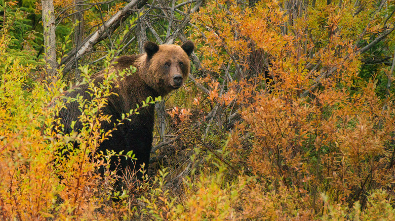
You won't find any services on route, so you'll need to carry all of your food with you or arrange food drops to be made by aircraft. Grizzlies and black bears frequent the trail too, so you're almost guaranteed to see a bear. Follow bear safety guidance strictly, particularly when storing your food at night in the dangerous camping destinations you may stop in on the backcountry route.
What to expect when hiking the Canol Heritage Trail in Canada's Northwest Territory
Intrepid trekkers undeterred by the length and the stringent safety procedures of the trail are in for a once-in-a-lifetime treat. There are two trailheads from which you can embark: the eastern, on the far side of the four-mile-wide Mackenzie River, and the western, close to the Yukon border and accessible by charter flight.
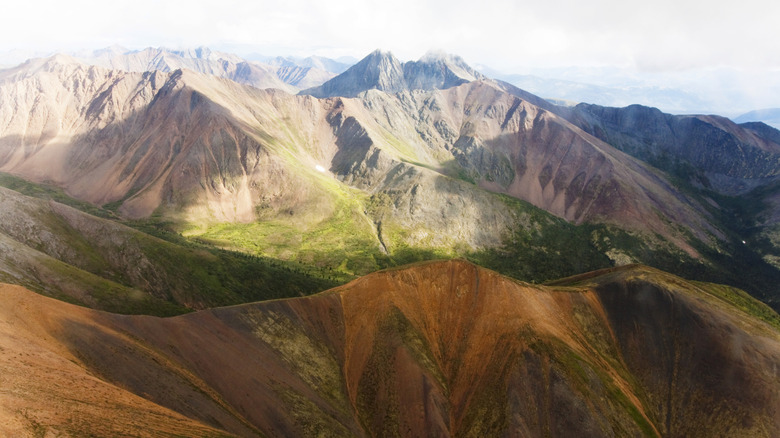
Starting on the eastern front, you can expect to hit highlights from the outset. You'll roam the water-woven Mackenzie Plains, separating the trailhead and the cascades of the Carcajou River. From the forest-fringed banks you work your way slowly into the Dodo Canyon, getting a supremely rare glimpse of the red-rock badlands lost in the ice-slicked wilds of northern Canada. The following stretch is tough, but rewarded with vertiginous views over the valleys and peaks of the Northwest Territories. You'll have to face the rapid currents of the Little Keele crossing, the laborious Blue Mountain section, and an ascent to gain the best vantage, on the trail's highest point, in the Plains of Abraham.
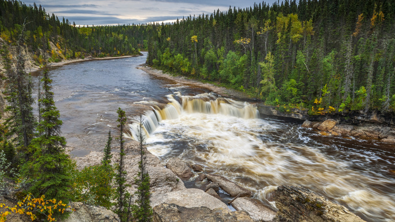
Working your way back down towards your western end point, you'll carry on over Devil's Pass, keeping an eye out for the mountain sheep, moose, and caribou that trot along the trailside. They'll be continual companions along your hike, joined by grizzlies moseying through their wild demesne and wolverines skulking in the boreal forests. The rest of the route navigates mighty rivers, leading you out to soaring vistas over the valleys of the Northwest Territories. Very rarely sighted, let alone hiked, you'll be one of the few travelers on earth to ever have witnessed North America's wildest corner up close.