Vibrant Purple Peaks Are A Photographer's Dream At This Colorful Hidden Gem In The Utah Desert
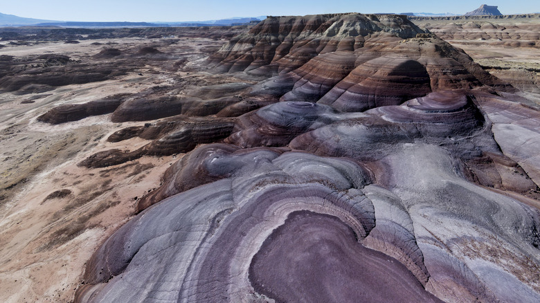
There's an out-of-this-world reason that The Mars Society chose Utah's Purple Hills for its almost-hidden Mars research facility. More formally known as the Bentonite Hills, this mountainous landscape of colorful purple peaks is a location where scientists have found environmental conditions similar to Mars, and hope that their research here can later recreate life on the Red Planet.
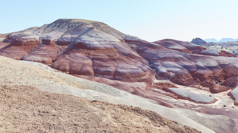
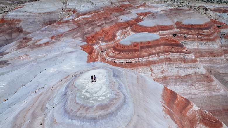
Situated about an hour outside the town of Hanksville, these hills were formed from layers of a type of volcanic ash known as bentonite clay (hence the name), sand, mud, and other sediments. Over millions of years, these minerals gave the peaks their iconic and almost alien-like purple, red, brown, and greenish hues, rivaling the majestic and fiery-red cliffs of Utah's Paria Canyon.
This uncanny and otherworldly marvel of nature, however, is not only a magnet for scientists. It is also a paradise for hikers, nature lovers, and, of course, adventurous landscape photographers seeking to witness the dreamy and unique scenery that seems to have come straight out of a sci-fi movie.
Exploring the vibrant purple peaks of Utah's Martian landscape
Southern Utah is home to impressive national parks and canyon destinations, with some resembling otherworldly views from another planet. Yet, the best place to feel like you're on Mars without leaving the Earth's crust is definitely the Bentonite Hills. The hills are conveniently located east of Capitol Reef National Park and north of Glen Canyon National Recreation Area, only about four hours away from Salt Lake City and about three hours from Moab.
To explore the different roads leading to the Bentonite Hills, you will need a vehicle that's able to traverse the mushy and rugged terrain along the way. The road's clay turns into sludge when combined with water, hence why 4x4 vehicles are the best choice for this venture (as well as avoiding the rainy season). You can access the hills by taking the Hartnet Road or Cathedral Valley Loop off of Utah Highway 24, with several viewpoints along the way where you can enjoy the fantastic scenery.
Another way is to travel toward the Mars Desert Research Station, but note that it is a private research facility and not open to visitors. From Hanksville, follow Utah State Route 24 until the off-the-beaten road leads you to the station. It is near the point known as Cow Dung Road. Continue driving until you notice the colorful peaks. This is your sign that you have arrived at your Mars-on-Earth destination.
Hiking and photographing the Purple Hills
Once you reach these beautiful hills, you can park your car at one of the designated areas and do some hiking. It is of utmost importance for hikers, photographers, and anyone adventuring through this geological marvel to keep to the already existing dirt roads. When hiking, stick to the trails, especially if you do not have climbing gear, and avoid disturbing any other untouched surfaces. The Bentonite clay forming the mounds is pretty delicate. Any damage to the surface (which also isn't very stable) will take many years to recover. As long as you follow the paths, you'll eventually reach high enough grounds to bask in the hills' glory and take some photos.
Speaking of which, the best time of day for photographing the hills is during the blue hour — just after sunset. Flying drones for aerial photos and videos of the Bentonite Hills is allowed as long as you don't trespass on the Mars Research Station or the Capitol Reef National Park. Camping is also permitted, just be mindful of respecting the delicate Bentonite environment.
Lastly, don't forget to bring water and snacks for your exploration of Utah's Mars, as there are no facilities whatsoever in the area. Bring a hat for sun protection, and please bring your trash back with you as well. Remember to also bring your camera, of course, and enjoy the fantastic sceneries of the otherworldly Purple Hills!


