One Of Canada's Most Bizarre Attractions Is A Roadside Traveler-Created Landmark You Can Add To
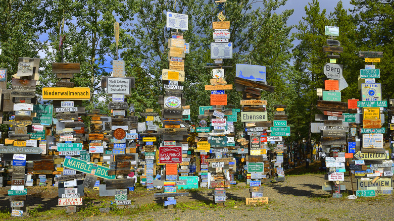
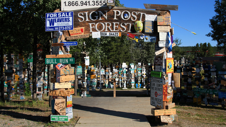
Anyone seeking a sign to inspire direction might want to start looking in Canada's Yukon territory. In fact, they'll find more than 77,000 of them at the intersection of Alaska Highway and Robert Campbell Highway in Watson Lake, nearly 250 miles east of this lakeside resort with northern lights views near Whitehorse, Yukon's capital city. All are packed into a 2-acre area called Sign Post Forest, making it one of the most unique roadside attractions in North America. And attract it does, as the ever-growing number of street signs, speed limit signs, city-boundary markers, license plates, hand-scrawled wood plaques, and more are provided by the visitors that trek there for that very purpose.
Most come from the United States and Canada, creating a kind of pushpin map giving shout-outs to thousands of hometowns from Tatamagouche, Nova Scotia, to Blacksburg, Virginia, to Fremont, Nebraska, to Gatineau, Quebec, and far beyond. Several cross the oceans, as well, including signs from Hamburg, Germany, Krakow, Poland, and Hythe, United Kingdom. All are mounted on wood posts, many as tall as trees, and arranged in rows like dominoes to give the impression of a forest, aided further by clumps of actual trees in and around them. Many of the signs, of course, are stolen from their respective locations; as Watson Lake Visitors Center supervisor Lelah Bruce admitted to Smithsonian Magazine, "It is the largest collection of stolen property never prosecuted, but of course we don't encourage it."
The lonely beginnings of the Sign Post Forest
All signs in the Sign Post Forest pay tribute to the first posted there in 1942 by U.S. soldier Carl K. Lindley. As a member of the Army Corp of Engineers, he was sent north to help construct the Alaska Highway connecting Dawson's Creek, British Columbia, to Delta Junction, Alaska, around 142 miles away from the world's largest year-round ice environment. The Alaska Highway was the most expensive project by the United States government during World War II, and it aimed to bolster defense against a Japanese invasion of North America.
After a dump truck ran over his foot, Lindley recovered at the Army Aid Station in Watson Lake. While there, he was asked to fix and paint a directional post damaged by a bulldozer. Clearly missing home, he added a sign for his hometown, saying "Danville, Illinois 2,835 miles." The idea caught on, first with other GIs and eventually with the rest of the world. It's also why many of the signs here note distance.
Today, the town of Watson Lake maintains the site, adding new posts as the number of signs grows. Next door is the Watson Lake Visitor Information Centre, where visitors can make their own sign to add. The center also hosts displays and exhibits with photos, murals, maps, and dioramas about the building of the Alaska Highway. See some of the construction vehicles that did the work amid the Sign Post Forest, many of which are also tagged and stuck with signs.

