An Underrated 400 Mile Trail Around The San Francisco Bay Is A Hiker And Biker's Paradise
When you think of the most ambitious infrastructure projects in American history, the Golden Gate Bridge, Hoover Dam, and the urban transportation networks spanning the country's major cities likely come to mind. However, the past four decades have also seen the quiet development of a project around the San Francisco Bay Area that has transformed the region for hikers, cyclists, and equestrians: Bay Area Ridge Trail.
The Bay Area Ridge Trail is a colossal circular route spanning nine Bay Area counties, which was first proposed in the early 1980s and began construction in 1989. Since then, more than 400 miles of the route have been opened to the public, with another 150 miles still to go before it is finally completed.
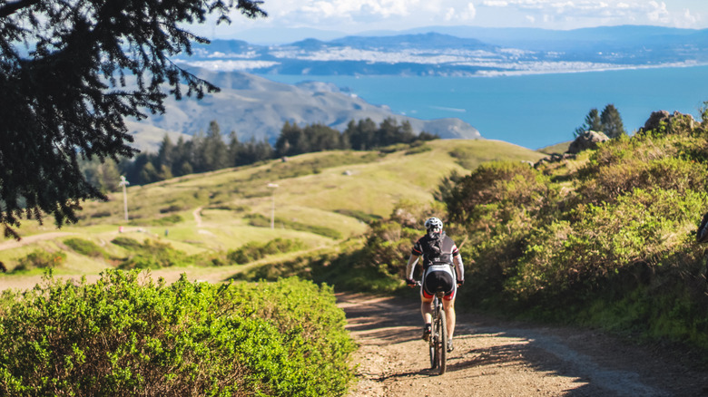
But you don't have to wait for the project to come to an end to enjoy the Bay Area Ridge Trail. As many expert hikers, cyclists, and horseback riders have made clear, the trail already offers some of the finest routes and most breathtaking views in the country, showcasing California's must-see sights.
Highlights of the Bay Area Ridge Trail
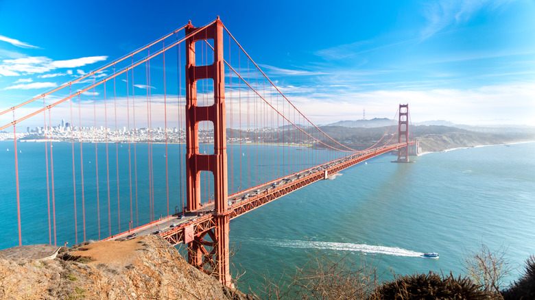
The central mission of the Bay Area Ridge Trail is to provide connected, scenic routes across the ridge lines above San Francisco Bay. The most thrilling vista along the way is possibly that of the Golden Gate Bridge. Its remarkable construction can be seen from some of the highest points in the area accessible by the trail. If you're lucky, you'll catch the bridge emerging from the bay's mist, with nearby valleys blanketed by clouds below.
But the bay is only one sight that the trail offers. After all, the circular route stretches all the way beyond Napa in the north and San Jose in the south. The western side of the route, which takes in both peninsulas connected by the Golden Gate Bridge, offers some of the finest panoramas of the Pacific Ocean (with sunsets you will not want to miss!). Meanwhile, the eastern portion of the circular, which, like other portions of the trail, crosses several county parks and preserves, has among its attractions jaw-dropping views of Mount Diablo.
Paths on the completed stretches of the Bay Area Ridge Trail are generally wide, well-maintained, and suitable for hikers, bicycles, and horses. A full outline of which routes carry such suitability is available on the Bay Area Ridge Trail website.
The Bay Area Ridge Trail: a flexible circular
The choice of which sections of the Bay Area Ridge Trail to tackle and in what order comes down to your personal preference, chosen form of transport, and the time and resources available when planning your trip. As Bay Area Ridge Trail Executive Director Janet McBride explains in the video above, a central aspect of the project's vision is that the trail provides visitors a chance to reconnect with the natural landscape and beauty of the San Francisco Bay Area whether they have a few weeks to commit to the route or just a few hours.
Completion of the entire trail is a major achievement. Those who have completed all open routes are listed on the Bay Area Ridge Trail website's Hall of Fame as "Circumnavigators." Currenty, there are only 55 Circumnavigators who completed the entire route. However, more casual hikers, cyclists, and riders tend to visit one stretch of the route at a time or tack two portions of the trail together.
There are several camping spots along the trail — including one secret beachside campground in the shadow of the Golden Gate Bridge — which may be ideal for multi-day hikes, while trail runners and cyclists, for instance, may simply park up at the start of a route and run to an endpoint and back again. The average segment is just 5.2 miles long and of varying difficulty. Ultimately, which portions you tackle and what rewards you take from the Bay Area Ridge Trail are up to you, and safety precautions are advised, particularly if going solo. Prefer to stick to roads? Here are our tips for one of California's best road trips with desert, forest, and alpine lake views.

