The 5 Best Fall Foliage Finder Resources
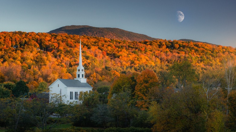
Some may say the most exciting part of fall is the Pumpkin Spice Latte, but don't forget about all the seasonal beauty and many fall activities to enjoy. Though scarce, some resources are available to introduce you to the best places to travel to see fall foliage. Having lived in Nevada's Mojave Desert for over 14 years, I've grown accustomed to the same basic colors year-round. When the fall foliage itch hits, though, thanks to the following five apps and website resources, I know where in the United States I can travel to satisfy the nostalgia of growing up amidst the rich seasonal colors of the East Coast.
To compile this list, I looked at the few fall foliage finder resources available and pinpointed a selection that offered the most information. Between websites and smartphone apps, these represent the most detailed and cover most (if not all) of the country. We'll dig a little more into our methodology at the end of this post.
Weather.com website
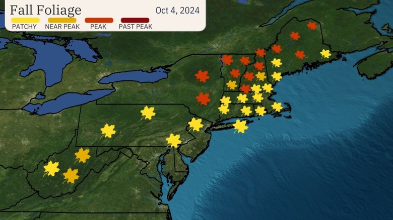
What better resource could there be to locate climate-related events than The Weather Channel, right? As much as this could have been the best resource, The Weather Channel's fall foliage maps are a little barebones. Still, they can play a vital role in helping you track the changing leaves across the nation. Weather.com provides frequently updated maps with an overview of whether the fall foliage is patchy, near peak, peak, or past peak. Ultimately, that translates to if the leaves just started turning yellow, if they're more orange, if they've gotten darker, and if they've mostly all died.
The maps aren't detailed enough to determine which specific cities are seeing what coverage, but it's a fine starting point. One of the more helpful maps is the "Typical Time of Peak Colors" map, which shows what time of the month you're more likely to see those burnt oranges and fiery reds. According to the map, a city like Atlanta will see peak colors much later in autumn, around late October, while fall colors in the southern half of Georgia will come in early November.
Since there are no real labels on each map detailing major cities or popular hotspots for fall activity, you may need to use Weather.com in conjunction with one of the following apps or websites. If you know a state well, you can determine a general idea of where to go for the best peak coverage.
The Foliage Report website
The Foliage Report starts with a big map of the United States, broken up into seven regions. No matter where you live, there's an opportunity to get a basic idea of where the nearest fall foliage will be. For example, if you want to see New York's foliage, you'll select it or another Northeast state from the map and then verify where the color change is the greatest via a zoomed-in section that covers all states in that region. Data is compiled from a number of resources, including The Weather Channel, individual state reports, and another source on our list, Explore Fall, and then condensed into an easy-to-read map.
The weekly updated website adjusts the colors based on a legend, where deep green suggests there is no fall color change and a dark brown indicates that the vibrant shades of red, orange, and yellow have given way to seasonal decay. Autumnal colors indicate prime fall foliage. The Foliage Report notes when the last update was and advises when the next update will be made so you can more easily keep up with the color change. One of this resource's biggest pitfalls is that the maps aren't detailed at all. There are no labels or geographical markers, so you have to guess where color changes are happening and shoot for nearby towns, parks, or landmarks.
Generally, you can determine a specific location by comparing The Foliage Report's map with a more detailed map that, at the very least, lists cities. You can also make an educated guess based on the fact that leaves change color at higher altitudes first.
Smoky Mountains website
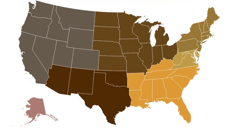
Despite its name, the Smoky Mountains website's Fall Foliage Prediction Map isn't reserved just for Tennessee and North Carolina's color change. It's an interactive map of the entire United States, complete with a slider that helps you get ahead of the best fall foliage. The slider is labeled with 12 days throughout the season, each a week apart. The map is accompanied by a seven-color legend, ranging from "No Change" to "Past Peak."
Though the map is a one-page interactive image, it's actually far more detailed than it appears. Unlike the Weather.com maps, each state is broken up by county. They're not labeled, but you can determine which counties are being covered by colorful foliage by searching for a county map of that state. For example, if you want to see the peak coverage in New York, you can pull up the official New York State website's list of counties and match a deep red quadrant from the Smoky Mountain's website to a shaded county on the state's site.
Outside of the lack of labels, the Smoky Mountain's prediction map is also a little too small for some states. Trying to determine what counties in Texas are covered in fall foliage will be a headache, as Texas has 254 separate counties — more than any other state. Some of the colors can also blend with the white outlines of the counties and states.
Gaia GPS app and website
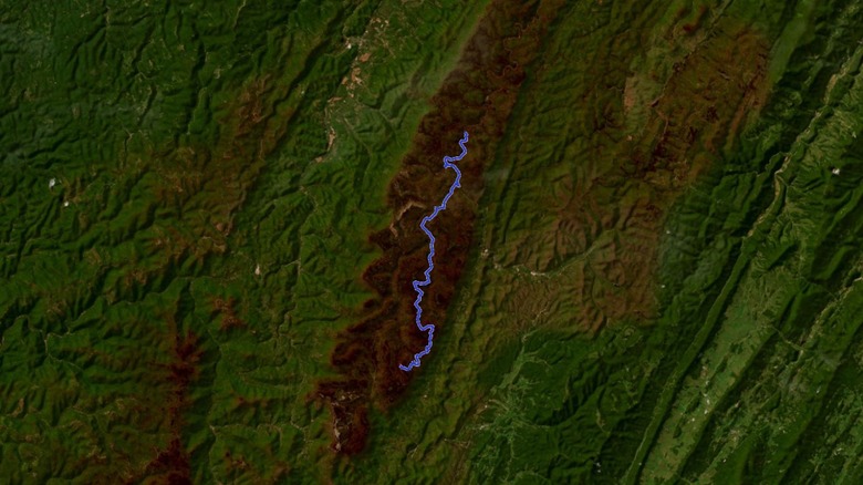
Gaia GPS' hiking app and website are fairly extensive resources for planning hiking routes through fall foliage. One of the more impressive features is the ability to layer maps, which lets you easily view the landscape details of one map and an overlay of a labeled topographic map at one time. Gaia GPS is best with a premium subscription (priced at about $60 per year), which gives you access to the World Imagery overlay you'll need for your foliage-finding expedition. You'll add the "FreshSat — Recent" and "FreshSat — Cloud Free" layers to the World Imagery overlay for a detailed map built from data that is no more than two weeks old. If there's fall foliage in the area, it will be visible on this map.
With a state or region in mind, use the Gaia GPS app (available on iPhone and Android) or website to create a route. To simply find a region where the color change is at its heaviest, you can refer to The Foliage Report. Then, place two waypoints: where you'll end and where you'll start (typically by parking). Gaia creates a walkable route for you to view that area, and the route is available on the website or mobile app. The app can even create a roundtrip if your start and end points are the same. If you don't like the initial path, you can click and drag the plotted line to find a different route.
Explore Fall website
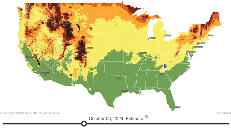
Explore Fall is the best fall foliage resource for one reason: The website lets you go state-by-state with just the click of a button. Rather than having you scroll around a map, trying to find the perfect spot, you can click your home state (or one you're interested in visiting for fall) and be immediately privy to an easy-to-read pop-out of that state. Not only do you get a color-coded map of the specific state, it's also labeled with major cities to give a frame of reference.
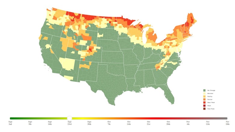
Alternative to going through each state individually, there is a full Fall Foliage Map that shows the color spread across the nation. You can pop in a city or zip code, and it will zoom in for a closer look at the fall coverage. As if all of this wasn't helpful enough, both the country and state maps have a slider to show the estimated fall coverage as the season goes on. Data is compiled via the Environmental Protection Agency, Garmin, TomTom, United States Geological Survey, and the National Oceanic and Atmospheric Administration, among other organizations, to try and deliver the most accurate fall foliage coverage.
If Explore Fall also charted paths like Gaia GPS, it would absolutely be the ultimate fall foliage finder. It covers every state in a way that makes it very easy to travel to unfamiliar territories to look for orange leaves. Unless you're in Hawaii, of course, where the leaves simply don't change color.
Our methodology
The internet is a jumbled mess of fall foliage resources, where many are either disabled or are a little too localized. For example, Vermont's official site has a fall foliage guide with a small map on the "Current Conditions," but how does that help our readers outside of or nowhere near the state? This would have been a much larger list if we wanted to highlight individual state guides, as states like Connecticut and Minnesota also have autumn foliage guides. So we looked specifically at resources that were nationwide or, while regional, covered more than one state.
To finalize the list, it all came down to which resources offered the most information. Gaia GPS is surprisingly helpful with its ability to overlay different maps and create coherent hiking trails for its users. The Foliage Report is also helpful, even if it doesn't offer specific labels as to which cities have the best fall foliage within a state. Of all the solid leaf-tracking options we found, Explore Fall is easily the cleanest and most user-friendly, and it includes many features we loved about other foliage-tracking or -predicting apps and websites. This isn't a ranked list, though — all of these resources are viable if you want to go out and drive, hike, or bike in the coolest fall foliage-blessed forests in the U.S.