Why This Iconic Mount Rainier National Park Hike Is One Of The World's Most Dangerous
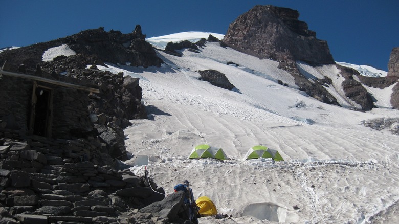
The centerpiece of Mount Rainier National Park is its 14,410-foot-tall namesake mountain. It's a part of the Washington Cascade Range, and it's ruggedly beautiful and wild. However, along with that wild beauty, the park can be dangerous. You don't even have to be going for the summit to be in the Mount Rainier danger zone. People have died making the 9-mile round trip hike up to Camp Muir. Named for the naturalist John Muir, the camp is as high as you can go on the mountain without a climbing permit and has shown itself to be the type of national park trail that should only be hiked by experts. The altitude, changing weather, and the conditions of snow and ice along the way can combine to make it a treacherous, even deadly hike.
To start with, the hike takes you up to 10,188 feet with a gain of nearly 4,800 feet in elevation. That's a steep, demanding hike, and the higher you get, the harder it becomes to breathe as the oxygen levels decrease. You run the risk of altitude sickness, which can cause headaches, fatigue, dizziness, and a loss of appetite. Dehydration also happens faster when you're at higher elevations, which can also cause irritation, disorientation, and fatigue. Dehydration and altitude sickness alone can be problematic, but the confusion they can cause could lead to hikers making dangerous mistakes on the trail. You have to have your wits about you, as conditions can change quickly.
The last stretch of the hike is through snow and ice
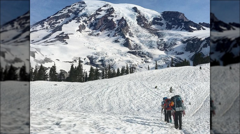
The whole adventure to and from Camp Muir can be entirely covered in snow. Even if there's no snow when you start, there will be as you get higher up. The first part of the hike up to Camp Muir is along the Skyline Trail, which starts at Paradise on the south side of the park. It's strenuous on its own, with plenty of steep sections, but it's nothing compared to when you turn off north and start heading across the Muir Snowfield. It is an unmarked upward climb for nearly 3,000 vertical feet over 2.2 miles that takes you through, as you might guess from the name, snow. Glaciers surround the snowfield, and there can be risks of avalanches. There are also crevasses and cliffs that could be hidden by snow.
Winds can blow you off course, and as it's a snowfield, it's not like there's a marked trail for you to follow. You'll need to be adept at route finding and orienteering to safely navigate the potentially treacherous terrain. Remember that reminder about how dehydration and altitude can cause havoc when it comes to decision-making? The Muir Snowfield is not where you want to fall apart, focus-wise.
Storms can make the conditions particularly deadly
Staying on course can also be a challenge through the Muir Snowfield, thanks to the weather. Conditions can turn bad quickly and unexpectedly, and the already-challenging terrain of the snowfield may be obscured by dense fog, which can be particularly disorienting. If you see a storm coming in, you might be better served by turning around. It can be disappointing to stop before you finish the hike, but it's literally a better safe than sorry situation, as pushing forward to and from Camp Muir through whiteout conditions can have tragic consequences. It's definitely not a place to try your amateur solo hiking skills. While you should still have your own orienteering skills, you could join a guided expedition if you are particularly worried about the trail.
All that being said, the rewards for the challenging hike are likely to include a sense of accomplishment, an increased confidence in your skills, and it's pretty much guaranteed to yield some amazing views of the surrounding mountains and glaciers. The Camp Muir hike is a serious hike that shouldn't be attempted without the right training and the proper gear. That doesn't mean it should be avoided, but you need to be aware of what you're getting into to help keep yourself safe and prevent putting anyone at risk to try and come rescue you if you get in trouble on the hike.


